Image

Construction & Infrastructure

Image

Industry Overview:

We support construction and infrastructure projects by delivering precise spatial data, advanced 3D mapping, and comprehensive material testing. Our services ensure that buildings, roads, bridges, and urban developments are executed safely, efficiently, and in full compliance with international standards.

The strength and reliability of every project depend on the quality of its materials, the accuracy of testing, and strict adherence to global benchmarks. From soil investigations to the completion of high-rise structures, our laboratory services form the foundation for sustainable and resilient construction.

Clients’ Needs & Challenges:

  • Conducting accurate topographic, geotechnical, and as-built surveys for planning, design, and permitting.
  • Verifying the quality and performance of construction materials.
  • Ensuring soil integrity and foundation stability before and during construction.
  • Meeting project specifications, safety requirements, and regulatory standards.
  • Preventing structural failures through timely testing and inspection.
  • Implementing real-time monitoring to track construction progress and ensure compliance.
Image

Value Proposition:

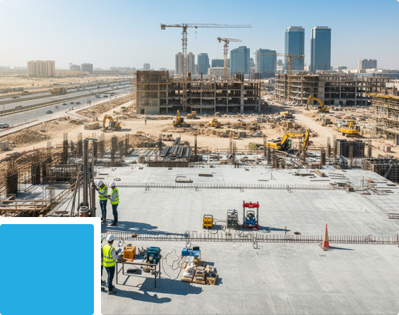
We help contractors, consultants, and developers achieve durability and compliance. As an independent third-party testing provider, GTS ensures that your projects are built on trust, backed by reliable data, and ready for long-term

  • Drone-based photogrammetry and LiDAR for high-resolution mapping and terrain modeling.
  • Comprehensive material testing, geotechnical investigations, and structural assessments to ensure safety and quality assurance.
  • 3D site visualization and progress monitoring to support both pre- and post-construction phases.
  • Terrestrial Laser Scanning (TLS) for precise structural surveys and seamless BIM integration.
  • Interactive deliverables in GIS, CAD, and BIM formats for efficient project planning and workflow integration.

Related Services:

Drone Survey Services

Image

Geotechnical & Geophysical Investigations

Image

Material Testing

Image

3D Scanning & Mobile Mapping Services

Image

GIS Mapping Services

Image

Surveyor & Instrument Hire Services

Image

Onsite Laboratory

Image

Inspection & Structural Assessments

Image
Up