Image

Utilities & Telecom

Image

Industry Overview:

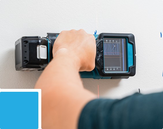
We provide comprehensive subsurface and overhead utility mapping combined with geotechnical and laboratory testing to support safe construction, asset management, and long-term infrastructure planning. Our integrated approach ensures reliable data for design, maintenance, and regulatory compliance.

Clients’ Needs & Challenges:

  • Accurate detection and mapping of underground utilities to prevent construction hazards.
  • Surveying utilities in congested urban environments with minimal disruption.
  • Integrating utility and geotechnical data into GIS for maintenance, planning, and decision-making.
  • Verifying material properties and soil conditions to support safe and compliant construction.
Image

Value Proposition:

  • Ground Penetrating Radar (GPR) and electromagnetic locators for precise subsurface detection.
  • High-accuracy GNSS mapping for CAD- and GIS-ready datasets.
  • Overhead line surveys and powerline inspections using drones and Terrestrial Laser Scanning (TLS).
  • Geotechnical and laboratory testing of soil and construction materials to ensure structural safety and regulatory compliance.

Related Services:

Drone Survey Services

Image

Geotechnical & Geophysical Investigations

Image

Material Testing

Image

3D Scanning & Mobile Mapping Services

Image

GIS Mapping Services

Image

Surveyor & Instrument Hire Services

Image

Onsite Laboratory

Image

Inspection & Structural Assessments

Image
Up