
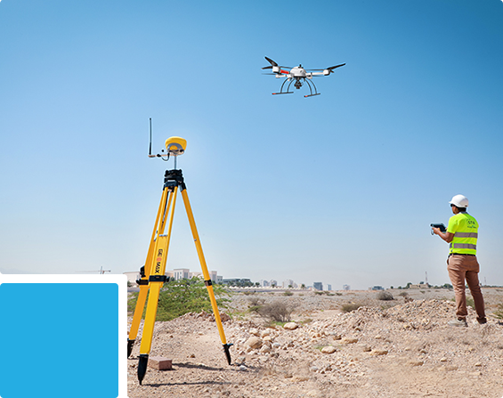
Aerial and Remote Sensing Survey Services in Oman

Aerial & Remote Sensing Services

Photogrammetric Survey

Photogrammetric Survey

We provide high-resolution aerial mapping using RGB photogrammetry cameras, survey control and advanced processing to generate accurate 2D and 3D spatial information.

Best For:
Topographical Surveys • Roads • Construction • Mining • Land Development • Earthworks • Infrastructure • Progress Mapping

Services & Deliverables:

  • High-Resolution Orthomosaics – Geo-referenced aerial imagery providing detailed and measurable site representation.
  • Topographical & Contour Mapping – Terrain, elevations, visible features and contours for engineering applications.
  • DTM / DSM Generation – Digital terrain and surface models for planning, design and analysis.
  • 3D Point Clouds & Surface Models – Dense spatial datasets for measurement, modelling and visualization.
  • CAD / GIS Outputs – Processed mapping data prepared for engineering, CAD and GIS workflows.

LiDAR Survey

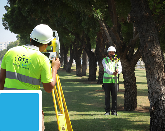
We provide high-density 3D laser mapping using LiDAR sensor payloads for accurate capture of terrain, infrastructure, corridors and complex or vegetated environments.

Drone-based LiDAR is used for detailed and flexible project coverage, while airborne LiDAR platforms may be deployed for extensive or large-scale survey areas.

Best For:
Corridors • Vegetated Terrain • Roads • Powerlines • Mining • Infrastructure • Slopes • Large Survey Areas

Services & Deliverables:

  • High-Density LiDAR Point Clouds – Detailed three-dimensional datasets generated from aerial laser measurements.
  • Ground / Non-Ground Classification – Separation of terrain from vegetation, structures and other surface features.
  • Bare-Earth Terrain Models – Ground-surface representation particularly suited to vegetated environments.
  • DTM / DSM & Contour Mapping – Elevation models, terrain surfaces and engineering contours.
  • Corridor & Terrain Analysis – Detailed mapping of roads, utilities, slopes and linear infrastructure.
LiDAR Survey
Multispectral & Hyperspectral Sensing

Multispectral & Hyperspectral Sensing

At GTS, we provide aerial spectral sensing using multispectral and hyperspectral sensor payloads to detect, analyse and classify vegetation, land and surface characteristics beyond conventional visual imagery.

Best For:
Agriculture • Crop Monitoring • Vegetation Studies • Environmental Projects • Land Screening • Mining • Surface Classification

Services & Deliverables:

  • Multispectral Sensing – Capture and analysis of selected spectral bands for vegetation, land and surface assessment.
  • Hyperspectral Sensing – Detailed spectral data acquisition for advanced material and surface differentiation.
  • Vegetation & Crop Health Analysis – Assessment of vegetation condition, density and relative health.
  • Spectral Indices & Classification – Generation of vegetation indices and classified thematic information.
  • GIS & Remote Sensing Outputs – Processed spectral datasets, thematic maps and GIS-ready information for analysis and monitoring.

Thermal Sensing & Asset Inspection

Our Thermal Sensing & Asset Inspection services provide aerial Thermal Infrared (TIR) sensing to detect, analyse and locate temperature variations, hotspots and thermal anomalies across assets, infrastructure and surfaces.

Thermal sensor payloads can be integrated with high-resolution RGB imagery and positioning data to provide accurate location-based inspection and documentation.

Best For:
Solar Farms • Buildings • Roofs • Electrical Assets • Industrial Facilities • Infrastructure • Specialized Inspections


Services & Deliverables:

  • Thermal Infrared Sensing – Capture and analysis of surface temperature variations and thermal patterns.
  • Solar PV Thermal Inspection – Detection and documentation of abnormal thermal behavior across solar installations.
  • Hotspot & Thermal Anomaly Detection – Identification and location of unusual temperature characteristics.
  • Thermal + RGB Documentation – Combined thermal and high-resolution visual imagery for improved interpretation.
  • Thermal Inspection Reports – Structured imagery, thermal findings, location data and inspection documentation.
Thermal Sensing & Asset Inspection
Magnetic Survey

Magnetic Survey

We provide drone-based magnetic surveying using high-sensitivity magnetometer payloads to measure variations in the Earth’s magnetic field and identify magnetic anomalies across project areas.

The ability to maintain systematic flight lines and consistent sensor coverage supports efficient magnetic data acquisition over difficult or extensive terrain.

Best For:
Mineral Exploration • Geological Surveys • Mining • Infrastructure Corridors • Buried Ferrous Features • Geophysical Investigations

Services & Deliverables:

  • Magnetic Data Acquisition – Systematic collection of geo-referenced magnetic measurements.
  • Magnetic Anomaly Mapping – Identification and spatial mapping of variations in the measured magnetic field.
  • High-Resolution Magnetic Grids – Processed magnetic surfaces supporting geophysical interpretation.
  • Profile & Corridor Magnetic Surveys – Magnetic data capture along defined grids, routes and project corridors.
  • GIS & Interpretation-Ready Outputs – Processed magnetic datasets, maps and profiles for technical assessment.

Aerial GPR Survey

We provide drone-based Ground-Penetrating Radar (GPR) sensing for non-invasive subsurface investigation and anomaly screening across suitable project environments.

Integrating GPR payloads with positioning information enables subsurface observations to be spatially referenced for engineering and geophysical assessment.

Best For:
Subsurface Investigations • Infrastructure • Geological Studies • Mining Areas • Engineering Surveys • Difficult-Access Terrain
Services & Deliverables:

  • Subsurface Data Acquisition – Systematic collection of radar measurements across defined survey areas.
  • Subsurface Anomaly Screening – Identification of potential subsurface variations and features for further assessment.
  • Geo-Referenced GPR Profiles – Radar information spatially linked to survey positioning.
  • Subsurface Mapping – Preparation of mapped radar responses and interpreted project areas.
  • GPR Maps & Technical Outputs – Processed profiles, maps and datasets for engineering or geophysical review.
Aerial GPR Survey
Up