
Reality Capture and Mobile Mapping Services in Oman

Reality Capture & Mobile Mapping Services

High-Precision 3D Scanning

High-Precision 3D Scanning

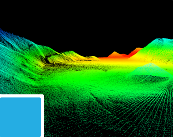
We provide high-detail 3D laser scanning for accurate capture of buildings, structures, industrial facilities, equipment and complex installations, producing dense and measurable point-cloud datasets of existing conditions.

Best For:
Buildings • Industrial Facilities • Oil & Gas • Plant Rooms • Structures • Bridges • MEP Installations • Renovation Projects

Services & Deliverables:

  • High-Density 3D Point Clouds – Detailed spatial datasets representing existing geometry, dimensions and site conditions.
  • Building & Structural Scanning – Accurate capture of structures, façades, interiors and architectural features.
  • Industrial & Plant Scanning – Detailed documentation of equipment, pipework, structural steel and complex installations.
  • Dimensional & Spatial Verification – Measurement of positions, elevations, dimensions, clearances and spatial relationships.
  • CAD / BIM Outputs – Registered point clouds, plans, sections, elevations and datasets prepared for CAD and Scan-to-BIM workflows.

Indoor & Complex-Site Mapping

Our Indoor & Complex-Site Mapping services provide rapid mobile 3D mapping for buildings, warehouses, construction sites, tunnels, underground areas and complex environments where efficient coverage and mobility are required.

Best For:
Warehouses • Buildings • Construction Sites • Tunnels • Underground Areas • Multi-Storey Facilities • Industrial Areas
Services & Deliverables:

  • Rapid 3D Site Capture – Continuous three-dimensional mapping while moving through the project environment.
  • Indoor & Outdoor SLAM Mapping – Efficient capture of connected internal and external areas.
  • Building & Facility Documentation – Spatial recording of rooms, corridors, staircases, warehouses and operational facilities.
  • Tunnel & Underground Mapping – Mobile mapping of confined and GNSS-denied environments.
  • SLAM Point Clouds & CAD Outputs – Processed datasets with plans, sections, profiles and required spatial information.
Indoor & Complex-Site Mapping
Large-Scale Laser Scanning

Large-Scale Laser Scanning

At GTS, we provide long-range 3D laser scanning for large structures, expansive sites, terrain, mines, quarries and difficult-to-access areas, enabling detailed remote measurement across larger distances.

Best For:
Bridges • Dams • Large Structures • Mines • Quarries • Highwalls • Terrain • Slopes • Towers • Infrastructure

Services & Deliverables:

  • Long-Range Point-Cloud Capture – Detailed 3D spatial information across extensive sites and distant features.
  • Large Structure Mapping – Three-dimensional capture of bridges, dams, towers and major infrastructure.
  • Terrain, Slope & Highwall Mapping – Detailed documentation of terrain surfaces, quarry faces, slopes and mining areas.
  • Remote Feature Measurement – Measurement of elevated, restricted or difficult-to-access features from safer locations.
  • Point Clouds & CAD Outputs – Registered datasets with plans, elevations, sections, profiles and surface information.

Mobile Mapping

Our Mobile Mapping services provide high-speed mobile LiDAR and imagery capture for efficient mapping of roads, highways, transportation networks and extensive infrastructure corridors.

Best For:
Highways • Urban Roads • Transportation Networks • Infrastructure Corridors • Road Assets • Utility Corridors • Large Developments
Services & Deliverables:

  • Mobile LiDAR Point Clouds – High-density georeferenced 3D datasets captured continuously along project corridors.
  • Road & Corridor Mapping – Detailed capture of road geometry, terrain, kerbs, medians, barriers and surrounding infrastructure.
  • Topographic & Surface Mapping – Extraction of levels, profiles, terrain and surface information across linear project areas.
  • Infrastructure & Asset Mapping – Identification and positioning of road furniture, signs, lighting, barriers and visible infrastructure assets.
  • CAD / GIS & Digital Outputs – Feature extraction, asset data, imagery, terrain models and structured digital corridor documentation.
Mobile Mapping
Up